
Cemeteries often make Jarrod Burks question whether he likes his job as a professional archaeologist.
His Columbus-based firm, Ohio Valley Archaeology Inc., conducts geophysical surveys of forgotten sites where the dead are laid to rest. But cemeteries, he said, are all the same and the hardest thing to tackle.
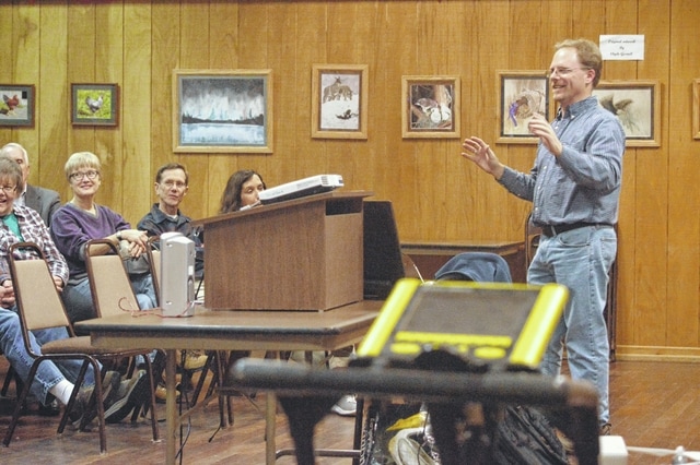
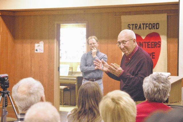
Burks gave a presentation to about 50 people at the Stratford Ecological Center, 3083 Liberty Road, Wednesday night to review his findings of the nonprofit’s more than 200-year-old cemetery from a survey carried out in August.
Surveying the Stratford Cemetery was not as easy compared with other Ohio cemeteries, he said.
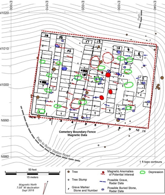
Plat and church records of the 8,250-square-foot cemetery continue to remain elusive. When the center opened in the 1990s, the cemetery was covered heavily in brush. Volunteers cleared away the brush to reveal what remains of the grave site during its 72-year-old usage period from 1816 to 1888. The boundaries are not clearly defined and some grave stones were broken, on the ground or illegible.
John Tetz spearheaded the historical research of the site. Prior to the survey, the volunteer determined there were at least 59 graves.
Online records show the site had about 68 burials, Burks said.
There were several maps of the Stratford area starting with one from 1848. The cemetery was missing from that edition, but first appeared on another map from 1866. Burks noted it was the first map of the Stratford Village.
The archaeologist gave a tutorial on the equipment he uses for the survey. Among them include a laser transit, magnometer and radar help find hints of burials in a row and the “mayhem in between,” Burk said.
“You never really know how this stuff will show up to the equipment.”
Mapping work was performed using a laser transit and 3D models from photographs, some done by a drone. This produced 118 stones, or 90 marked graves. The magnometer uncovered the remains of the cemetery’s fence and three possible early American Indian pit-type features, while the radar detected potentially more buried stones and graves.
In total, the survey identified 90 marked and 18 possible unmarked graves for a total of 108.
But the layout of the graves almost matches up with a map crafted by the Works Progress Administration, a U.S. agency from the Great Depression era. But the archival document does not indicate if each of the “127 rectangles” is a burial plot or an actual grave, Burks said.
“It looks like a lot what we found,” he said. “… It’s arranged in such a weird way that it might be graves.”
“It’s pretty close but these WPA maps aren’t exact,” he added.
The center plans to start “probing” the cemetery in the spring, Tetz said, and needs about 20 volunteers.
“We need a lot of help,” he said.
The center’s Executive Director Jeff Dickinson said the project has gained a “heck of a lot of momentum” and that they continue to look for new funding sources.
“Who knows how far we can take it,” he said.


