
Berlin Township residents are invited to review the final draft of the comprehensive land use plan (CLUP) at 7 p.m. Sept. 13 in the Township Hall, 3271 Cheshire Road, Delaware.
The plan is currently on view at the hall’s Zoning Office Monday through Thursday from 8 a.m. to 5:30 p.m., as well as on the township website. The public meeting is being held to give residents the opportunity to ask questions. In attendance at the meeting will be the Berlin Township Zoning Commission and Scott Sanders, director of the Delaware County Regional Planning Commission (DCRPC).
An executive summary at the beginning of the 120-page main section of the plan provides a clue as to why the CLUP is needed. Since 1990, Berlin has been one of the fastest growing townships in the fastest growing county in Ohio.
“However, based on activity within the last two years, DCRPC projects the township grew another 7.3% between 2020 and 2022,” the summary said. “Berlin’s neighbor to the south, Orange Township, has (also) grown … This growth wave is pushing north along the sanitary sewer line on South Old State Road, changing agriculture into suburban residential development.”
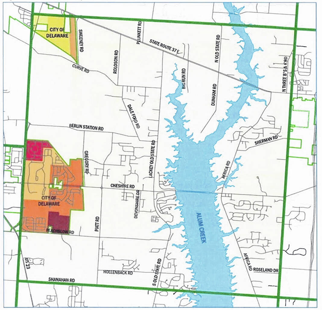
A section on land use notes that more than 8% of the township (1,366 acres) has been annexed into the city of Delaware.
“The township saw 2,625 acres rezoned since 2010,” the plan said. “The only area with large tracts of agriculture is along U.S. Route 36/State Route 37.”
While traffic remains a problem at times, a number of road improvements — roundabouts, widenings, extensions and relocations — have been completed recently, the plan said.
The CLUP has 13 chapters, starting with the history of Berlin (one community was once known as Tanktown) and concluding with goals and implementation.
The other chapters are split into sections for the county as a whole and then the township. These chapters go over demographics, development, land use, natural resources, housing, economic development/conditions, roads and transportation, utilities, community facilities (with a separate section on schools), open space and development patterns.
The plan divides the township into 10 areas and has recommendations for each area. For example, one of the areas is called the “Historic Village of Cheshire and Surrounding Area,” and one of the recommendations for the unincorporated village is a mixed use planned district with commercial and residential uses.
Finally, a map of the township, prepared last month by DCRPC, provides an illustrational representation of those recommendations.


